
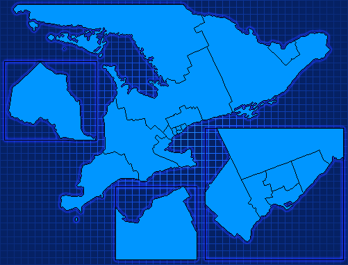
This map is the official map for Ontario 2018, based on the 2013 redistricting but should be good as a basis for historical campaigns as well.
Here is the bitmap version.
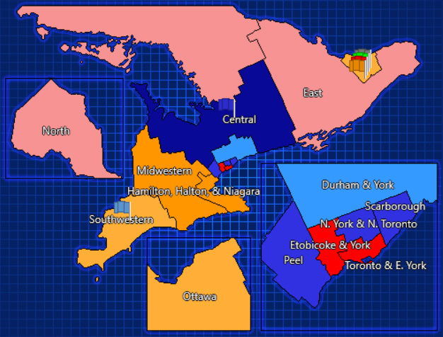
Here is the Photoshop source, which contains separate layers so you can move things around, as well as region labels so you can see what each region is.
Here’s an example of the map in action (colours are not correct for Ontario 2018, included to show the regions).
Looks great! Working on an Ontario campaign now.
Sounds good!